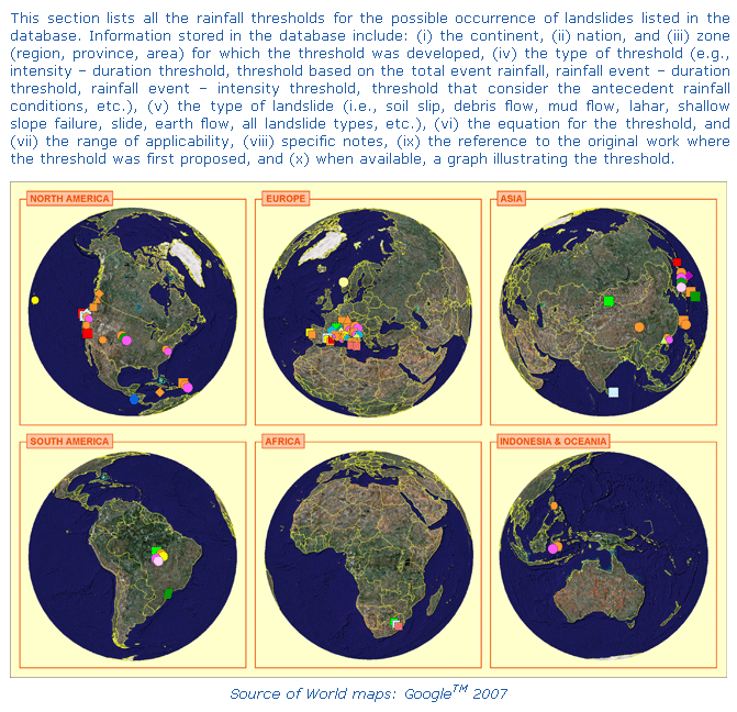
|
Continent | Nation | Zone | Threshold type | Landslide code | Equation | Range | Notes | Reference | Image |
| Africa | South Africa | Natal Group, Durban Area, KwaZulu-Natal | E | A | E(2h) > 100-150 mm | n.a. | n.a. | Bell FG, Maud RR (2000) Landslides associated with the colluvial soils overlying the Natal Group in the greater Durban region of Natal, South Africa. Environ Geol 39(9): 1029–1038 | Graphic |
| Africa | South Africa | Natal Group, Durban Area, KwaZulu-Natal | A(d) | A | A(15d) > 450 mm | n.a. | n.a. | Bell FG, Maud RR (2000) Landslides associated with the colluvial soils overlying the Natal Group in the greater Durban region of Natal, South Africa. Environ Geol 39(9): 1029–1038 | Graphic |
| Africa | South Africa | Natal Group, Durban Area, KwaZulu-Natal | EMAP | A | 0.16 < EMAP < 0.20 | n.a. | Moderate events (3 to 6 landslides) | Bell FG, Maud RR (2000) Landslides associated with the colluvial soils overlying the Natal Group in the greater Durban region of Natal, South Africa. Environ Geol 39(9): 1029–1038 | Graphic |
| Africa | South Africa | Natal Group, Durban Area, KwaZulu-Natal | EMAP | A | EMAP > 0.20 | n.a. | Severe events (> 10 landslides) | Bell FG, Maud RR (2000) Landslides associated with the colluvial soils overlying the Natal Group in the greater Durban region of Natal, South Africa. Environ Geol 39(9): 1029–1038 | Graphic |
| Africa | South Africa | Natal Group, Durban Area, KwaZulu-Natal | EMAP | A | EMAP < 0.12 | n.a. | Landslides do not occur | Bell FG, Maud RR (2000) Landslides associated with the colluvial soils overlying the Natal Group in the greater Durban region of Natal, South Africa. Environ Geol 39(9): 1029–1038 | Graphic |
| Africa | South Africa | Natal Group, Durban Area, KwaZulu-Natal | EMAP | A | 0.12 < EMAP < 0.16 | n.a. | Minor events (1 or 2 landslides) | Bell FG, Maud RR (2000) Landslides associated with the colluvial soils overlying the Natal Group in the greater Durban region of Natal, South Africa. Environ Geol 39(9): 1029–1038 | Graphic |
| Asia | China | n.a. | ID | D | I = 49.11-6.81×D1.00 | 1 < D < 5 | n.a. | Jibson RW (1989) Debris flow in southern Porto Rico. Geological Society of America, Special Paper 236, 29–55 | Graphic |
| Asia | Hong Kong | n.a. | A(d), R | S | A(15d) > 200 mm and R > 100 mm | n.a. | Severe events | Lumb P (1975) Slope failure in Hong Kong. Q J Eng Geol 8:31-65 | Graphic |
| Asia | Hong Kong | n.a. | A(d), R | S | A(15d) > 350 mm and R > 100 mm | n.a. | Very severe events | Lumb P (1975) Slope failure in Hong Kong. Q J Eng Geol 8:31-65 | Graphic |
| Asia | Hong Kong | n.a. | A(d), R | S | A(15d) > 50 mm and R > 50 mm | n.a. | Minor events | Lumb P (1975) Slope failure in Hong Kong. Q J Eng Geol 8:31-65 | Graphic |
| Asia | Hong Kong | n.a. | ID | D | I = 41.83 ×D-0.58 | 1 < D < 12 | n.a. | Jibson RW (1989) Debris flow in southern Porto Rico. Geological Society of America, Special Paper 236, 29–55 | Graphic |
| Asia | Hong Kong | n.a. | IMAPD | D | IMAP = 0.02×D-0.68 | 1 < D < 12 | n.a. | Jibson RW (1989) Debris flow in southern Porto Rico. Geological Society of America, Special Paper 236, 29–55 | Graphic |
| Asia | Indonesia | n.a. | IMAPD | D | IMAP = 0.07-0.01×D1.00 | 2 < D < 24 | n.a. | Jibson RW (1989) Debris flow in southern Porto Rico. Geological Society of America, Special Paper 236, 29–55 | Graphic |
| Asia | Indonesia | n.a. | ID | D | I = 92.06-10.68×D1.00 | 2 < D < 4 | n.a. | Jibson RW (1989) Debris flow in southern Porto Rico. Geological Society of America, Special Paper 236, 29–55 | Graphic |
| Asia | Japan | Chiba and Kanagawa prefectures | IMAXE | Sh | Imax = 150 × E-0.38 | 0 < E < 200 | Lower threshold | Onodera T, Yoshinaka R, Kazama H (1974) Slope failures caused by heavy rainfall in Japan. In: Proceedings of the 2nd International Congress of the International Association of Engineering Geology. Sao Paulo, Brazil, 11: 1-10 | Graphic |
| Asia | Japan | Chiba and Kanagawa prefectures | IMAXE | Sh | Imax = 290 × E-0.38 | 0 < E < 300 | Intermediate threshold | Onodera T, Yoshinaka R, Kazama H (1974) Slope failures caused by heavy rainfall in Japan. In: Proceedings of the 2nd International Congress of the International Association of Engineering Geology. Sao Paulo, Brazil, 11: 1-10 | Graphic |
| Asia | Japan | Chiba and Kanagawa prefectures | IMAXE | Sh | Imax = 390 × E-0.38 | 0 < E < 400 | Upper threshold (major disaster) | Onodera T, Yoshinaka R, Kazama H (1974) Slope failures caused by heavy rainfall in Japan. In: Proceedings of the 2nd International Congress of the International Association of Engineering Geology. Sao Paulo, Brazil, 11: 1-10 | Graphic |
| Asia | Japan | Hokkaido Island | R | A | R > 200 mm | n.a. | n.a. | Endo T (1970) Probable distribution of the amount of rainfall causing landslides. Annual report, Hokkaido Branch, Govern. Forest Experiment Station, Sapporo, 123-136 | Graphic |
| Asia | Japan | n.a. | IE | D | I = 112.25 - 0.20×E | 165 < E < 440 | n.a. | Jibson RW (1989) Debris flow in southern Porto Rico. Geological Society of America, Special Paper 236, 29–55 | Graphic |
| Asia | Japan | n.a. | IMAPEMAP | D | IMAP = 0.04 - 0.19 × EMAP | 0 < EMAP < 0.22 | n.a. | Jibson RW (1989) Debris flow in southern Porto Rico. Geological Society of America, Special Paper 236, 29–55 | Graphic |
| Asia | Japan | n.a. | IMAPEMAP | D | IMAP = 0.04 × e-3.55×EMAP | 0.03 < EMAP < 0.25 | n.a. | Jibson RW (1989) Debris flow in southern Porto Rico. Geological Society of America, Special Paper 236, 29–55 | Graphic |
| Asia | Japan | n.a. | IMAPD | D | IMAP = 0.03×D-0.63 | 1 < D < 12 | n.a. | Jibson RW (1989) Debris flow in southern Porto Rico. Geological Society of America, Special Paper 236, 29–55 | Graphic |
| Asia | Japan | n.a. | ID | D | I = 39.71 ×D-0.62 | 0.5 < D < 12 | n.a. | Jibson RW (1989) Debris flow in southern Porto Rico. Geological Society of America, Special Paper 236, 29–55 | Graphic |
| Asia | Japan | n.a. | IE | D | I = 67.38 × E-0.0023×E | 50 < E < 400 | n.a. | Jibson RW (1989) Debris flow in southern Porto Rico. Geological Society of America, Special Paper 236, 29–55 | Graphic |
| Asia | Japan | Shikoku Island | ID | A | I = 1.35+55×D-1.00 | 24 < D < 300 | n.a. | Hong Y, Hiura H, Shino K, Sassa K, Suemine A, Fukuoka H Wang G (2005) The influence of intense rainfall on the activity of large-scale crystalline schist landslides in Shikoku Island, Japan. Landslides 2(2): 97-105 | Graphic |
| Asia | Japan | Shikoku Island | IE | A | I = 1000 × E-1.23 | 100 < E < 230 | n.a. | Hong Y, Hiura H, Shino K, Sassa K, Suemine A, Fukuoka H Wang G (2005) The influence of intense rainfall on the activity of large-scale crystalline schist landslides in Shikoku Island, Japan. Landslides 2(2): 97-105 | Graphic |
| Asia | n.a. | n.a. | EMAP | A | 0.05 < EMAP < 0.10 | n.a. | Intermediate probability of landslides | Bhandari RK, Senanayake KS, Thayalan N (1991) Pitfalls in the prediction on landslide through rainfall data. In: Landslides (Bell DH, ed). Rotterdam: A.A. Balkema, 2: 887–890 | Graphic |
| Asia | n.a. | n.a. | EMAP | A | EMAP > 0.20 | n.a. | Landslides will always occur | Bhandari RK, Senanayake KS, Thayalan N (1991) Pitfalls in the prediction on landslide through rainfall data. In: Landslides (Bell DH, ed). Rotterdam: A.A. Balkema, 2: 887–890 | Graphic |
| Asia | n.a. | n.a. | EMAP | A | EMAP < 0.05 | n.a. | Low probability of landslides | Bhandari RK, Senanayake KS, Thayalan N (1991) Pitfalls in the prediction on landslide through rainfall data. In: Landslides (Bell DH, ed). Rotterdam: A.A. Balkema, 2: 887–890 | Graphic |
| Asia | n.a. | n.a. | EMAP | A | 0.10 < EMAP < 0.20 | n.a. | High probability of landslides | Bhandari RK, Senanayake KS, Thayalan N (1991) Pitfalls in the prediction on landslide through rainfall data. In: Landslides (Bell DH, ed). Rotterdam: A.A. Balkema, 2: 887–890 | Graphic |
| Asia | Philippines | Mayon Volcano, Albay, Bicol | ID | L | I = 27.3×D-0.38 | 0.167 < D < 3 | n.a. | Rodolfo KS, Arguden AT (1991) Rain-lahar generation and sediment-delivery systems at Mayon Volcano, Philippines. In: Sedimentation in volcanic settings (Fisher RV, Smith GA, eds). Society of Economic Paleontologists and Mineralogists, Special Publication 45: 71–88 | Graphic |
| Asia | Philippines | Pasig Potrero River, Central Luzon | ID | L | I = 9.23×D-0.37 | 0.08 < D < 7.92 | n.a. | Arboleda RA, Martinez ML (1996) 1992 lahars in the Pasig-Potrero River system. In: Fire and mud: eruptions and lahars of Mount Pinatubo (Newhall CG, Punongbayan RS, eds). Philippine Institute of Volcanology and Seismology, Quezon City and University of Washington Press, Seattle, 1126 pp | Graphic |
| Asia | Philippines | Sacobia River, Mount Pinatubo, Central Luzon | ID | L | I = 5.94×D-1.50 | 0.167 < D < 3 | n.a. | Tuńgol NM, Regalado MTM (1996) Rainfall, acoustic flow monitor records, and observed lahars of the Sacobia River in 1992. In: Fire and mud: eruptions and lahars of Mount Pinatubo (Newhall CG, Punongbayan RS, eds). Philippine Institute of Volcanology and Seismology, Quezon City and University of Washington Press, Seattle, 1126 pp | Graphic |
| Asia | Sri Lanka | n.a. | E | A | E(3d) > 200 mm | n.a. | n.a. | Bhandari RK, Senanayake KS, Thayalan N (1991) Pitfalls in the prediction on landslide through rainfall data. In: Landslides (Bell DH, ed). Rotterdam: A.A. Balkema, 2: 887–890 | Graphic |
| Asia | Taiwan | Central Taiwan | ID | D | I = 6.7×D-0.20 | 0.7 < D < 40 | After Chi-Chi earthquake | Jan CD, Chen CL (2005) Debris flows caused by Typhoon Herb in Taiwan. In: Debris flow Hazards and Related Phenomena (Jakob M, Hungr O, eds). Springer Berlin Heidelberg, 363-385 | Graphic |
| Asia | Taiwan | Central Taiwan | ID | D | I = 13.5×D-0.20 | 0.7 < D < 40 | Before Chi-Chi earthquake | Jan CD, Chen CL (2005) Debris flows caused by Typhoon Herb in Taiwan. In: Debris flow Hazards and Related Phenomena (Jakob M, Hungr O, eds). Springer Berlin Heidelberg, 363-385 | Graphic |
| Asia | Taiwan | n.a. | ID | A | I = 115.47×D-0.80 | 1 < D < 400 | n.a. | Chien-Yuan C, Tien-Chien C, Fan-Chieh Y, Wen-Hui Y, Chun-Chieh T (2005) Rainfall duration and debris-flow initiated studies for real-time monitoring. Environmental Geology 47: 715-724 | Graphic |
| Europe | Austria | Carinthia and East Tyrol | ID | S | I = 41.66×D-0.77 | 1 < D < 1000 | n.a. | Moser M, Hohensinn F (1983) Geotechnical aspects of soil slips in Alpine regions. Engineering Geology 19: 185–211 | Graphic |
| Europe | Central and Southern Europe | n.a. | IMAPD | A | IMAP = 0.0015×D-0.71 | 0.1 < D < 4000 | Mild, mid-latitude climates | Guzzetti F, Peruccacci S, Rossi M, Stark CP (2007) Rainfall threholds for the initiation of landslides in central and southern Europe. Meteorology and Atmospheric Physics 98: 239-267 | Graphic |
| Europe | Central and Southern Europe | n.a. | ID | A | I = 9.40×D-0.56 | 0.1 < D < 4000 | n.a. | Guzzetti F, Peruccacci S, Rossi M, Stark CP (2007) Rainfall threholds for the initiation of landslides in central and southern Europe. Meteorology and Atmospheric Physics 98: 239-267 | Graphic |
| Europe | Central and Southern Europe | n.a. | ID | A | I = 8.76×D-0.61 | 0.1 < D < 700 | (Threshold obtained from probability estimates of rainfall data) | Guzzetti F, Peruccacci S, Rossi M, Stark CP (2007) Rainfall threholds for the initiation of landslides in central and southern Europe. Meteorology and Atmospheric Physics 98: 239-267 | Graphic |
| Europe | Central and Southern Europe | n.a. | ID | A | I = 0.52×D-0.16 | 300 < D < 4000 | (Threshold obtained from probability estimates of rainfall data) | Guzzetti F, Peruccacci S, Rossi M, Stark CP (2007) Rainfall threholds for the initiation of landslides in central and southern Europe. Meteorology and Atmospheric Physics 98: 239-267 | Graphic |
| Europe | Central and Southern Europe | n.a. | ID | A | I = 15.56×D-0.70 | 0.1 < D < 4000 | Mild, mid-latitude climates | Guzzetti F, Peruccacci S, Rossi M, Stark CP (2007) Rainfall threholds for the initiation of landslides in central and southern Europe. Meteorology and Atmospheric Physics 98: 239-267 | Graphic |
| Europe | Central and Southern Europe | n.a. | ID | A | I = 18.60×D-0.81 | 0.1 < D < 700 | Mild, mid-latitude climates (Threshold obtained from probability estimates of rainfall data) | Guzzetti F, Peruccacci S, Rossi M, Stark CP (2007) Rainfall threholds for the initiation of landslides in central and southern Europe. Meteorology and Atmospheric Physics 98: 239-267 | Graphic |
| Europe | Central and Southern Europe | n.a. | ID | A | I = 0.82×D-0.19 | 300 < D < 4000 | Mild, mid-latitude climates (Threshold obtained from probability estimates of rainfall data) | Guzzetti F, Peruccacci S, Rossi M, Stark CP (2007) Rainfall threholds for the initiation of landslides in central and southern Europe. Meteorology and Atmospheric Physics 98: 239-267 | Graphic |
| Europe | Central and Southern Europe | n.a. | ID | A | I = 7.56×D-0.48 | 0.1 < D < 3000 | Highlands, severe mid-latitude climates | Guzzetti F, Peruccacci S, Rossi M, Stark CP (2007) Rainfall threholds for the initiation of landslides in central and southern Europe. Meteorology and Atmospheric Physics 98: 239-267 | Graphic |
| Europe | Central and Southern Europe | n.a. | ID | A | I = 8.53×D-0.64 | 0.1 < D < 3000 | Highlands, severe mid-latitude climates (Threshold obtained from probability estimates of rainfall data) | Guzzetti F, Peruccacci S, Rossi M, Stark CP (2007) Rainfall threholds for the initiation of landslides in central and southern Europe. Meteorology and Atmospheric Physics 98: 239-267 | Graphic |
| Europe | Central and Southern Europe | n.a. | IMAPD | A | IMAP = 0.007×D-0.54 | 0.1 < D < 4000 | n.a. | Guzzetti F, Peruccacci S, Rossi M, Stark CP (2007) Rainfall threholds for the initiation of landslides in central and southern Europe. Meteorology and Atmospheric Physics 98: 239-267 | Graphic |
| Europe | Central and Southern Europe | n.a. | IMAPD | A | IMAP = 0.0064×D-0.64 | 0.1 < D < 700 | (Threshold obtained from probability estimates of rainfall data) | Guzzetti F, Peruccacci S, Rossi M, Stark CP (2007) Rainfall threholds for the initiation of landslides in central and southern Europe. Meteorology and Atmospheric Physics 98: 239-267 | Graphic |
| Europe | Central and Southern Europe | n.a. | IMAPD | A | IMAP = 0.00066×D-0.13 | 300 < D < 4000 | (Threshold obtained from probability estimates of rainfall data) | Guzzetti F, Peruccacci S, Rossi M, Stark CP (2007) Rainfall threholds for the initiation of landslides in central and southern Europe. Meteorology and Atmospheric Physics 98: 239-267 | Graphic |
| Europe | Central and Southern Europe | n.a. | IMAPD | A | IMAP = 0.0194×D-0.73 | 0.1 < D < 700 | Mild, mid-latitude climates (Threshold obtained from probability estimates of rainfall data) | Guzzetti F, Peruccacci S, Rossi M, Stark CP (2007) Rainfall threholds for the initiation of landslides in central and southern Europe. Meteorology and Atmospheric Physics 98: 239-267 | Graphic |
| Europe | Central and Southern Europe | n.a. | IMAPD | A | IMAP = 0.00099×D-0.19 | 300 < D < 4000 | Mild, mid-latitude climates (Threshold obtained from probability estimates of rainfall data) | Guzzetti F, Peruccacci S, Rossi M, Stark CP (2007) Rainfall threholds for the initiation of landslides in central and southern Europe. Meteorology and Atmospheric Physics 98: 239-267 | Graphic |
| Europe | Central and Southern Europe | n.a. | IMAPD | A | IMAP = 0.008×D-0.51 | 0.1 < D < 3000 | Highlands, severe mid-latitude climates | Guzzetti F, Peruccacci S, Rossi M, Stark CP (2007) Rainfall threholds for the initiation of landslides in central and southern Europe. Meteorology and Atmospheric Physics 98: 239-267 | Graphic |
| Europe | Central and Southern Europe | n.a. | IMAPD | A | IMAP = 0.0064×D-0.63 | 0.1 < D < 3000 | Highlands, severe mid-latitude climates (Threshold obtained from probability estimates of rainfall data) | Guzzetti F, Peruccacci S, Rossi M, Stark CP (2007) Rainfall threholds for the initiation of landslides in central and southern Europe. Meteorology and Atmospheric Physics 98: 239-267 | Graphic |
| Europe | Central and Southern Europe | n.a. | IRDND | A | IRDN = 1.18×D-0.56 | 0.1 < D < 4000 | n.a. | Guzzetti F, Peruccacci S, Rossi M, Stark CP (2007) Rainfall threholds for the initiation of landslides in central and southern Europe. Meteorology and Atmospheric Physics 98: 239-267 | Graphic |
| Europe | Central and Southern Europe | n.a. | IRDND | A | IRDN = 1.01×D-0.61 | 0.1 < D < 700 | (Threshold obtained from probability estimates of rainfall data) | Guzzetti F, Peruccacci S, Rossi M, Stark CP (2007) Rainfall threholds for the initiation of landslides in central and southern Europe. Meteorology and Atmospheric Physics 98: 239-267 | Graphic |
| Europe | Central and Southern Europe | n.a. | IRDND | A | IRDN = 0.072×D-0.10 | 300 < D < 4000 | (Threshold obtained from probability estimates of rainfall data) | Guzzetti F, Peruccacci S, Rossi M, Stark CP (2007) Rainfall threholds for the initiation of landslides in central and southern Europe. Meteorology and Atmospheric Physics 98: 239-267 | Graphic |
| Europe | Central and Southern Europe | n.a. | IRDND | A | IRDN = 2.18×D-0.70 | 0.1 < D < 4000 | Mild, mid-latitude climates | Guzzetti F, Peruccacci S, Rossi M, Stark CP (2007) Rainfall threholds for the initiation of landslides in central and southern Europe. Meteorology and Atmospheric Physics 98: 239-267 | Graphic |
| Europe | Central and Southern Europe | n.a. | IRDND | A | IRDN = 2.79×D-0.76 | 0.1 < D < 700 | Mild, mid-latitude climates (Threshold obtained from probability estimates of rainfall data) | Guzzetti F, Peruccacci S, Rossi M, Stark CP (2007) Rainfall threholds for the initiation of landslides in central and southern Europe. Meteorology and Atmospheric Physics 98: 239-267 | Graphic |
| Europe | Central and Southern Europe | n.a. | IRDND | A | IRDN = 0.138×D-0.19 | 300 < D < 4000 | Mild, mid-latitude climates (Threshold obtained from probability estimates of rainfall data) | Guzzetti F, Peruccacci S, Rossi M, Stark CP (2007) Rainfall threholds for the initiation of landslides in central and southern Europe. Meteorology and Atmospheric Physics 98: 239-267 | Graphic |
| Europe | Central and Southern Europe | n.a. | IRDND | A | IRDN = 1.18×D-0.56 | 0.1 < D < 3000 | Highlands, severe mid-latitude climates | Guzzetti F, Peruccacci S, Rossi M, Stark CP (2007) Rainfall threholds for the initiation of landslides in central and southern Europe. Meteorology and Atmospheric Physics 98: 239-267 | Graphic |
| Europe | Central and Southern Europe | n.a. | IRDND | A | IRDN = 0.99×D-0.63 | 0.1 < D < 3000 | Highlands, severe mid-latitude climates (Threshold obtained from probability estimates of rainfall data) | Guzzetti F, Peruccacci S, Rossi M, Stark CP (2007) Rainfall threholds for the initiation of landslides in central and southern Europe. Meteorology and Atmospheric Physics 98: 239-267 | Graphic |
| Europe | Italy | Apuane Alps, Tuscany | ID | Sh | I = 26.871×D-0.638 | 0.1 < D < 35 | Lower threshold | Giannecchini R (2005) Rainfall triggering soil slips in the southern Apuane Alps (Tuscany, Italy). Advances in Geosciences 2: 21-24 | Graphic |
| Europe | Italy | Apuane Alps, Tuscany | EMAPI | Sh | EMAP = 6.5471 - 1.4916 × ln I | 3 < I < 50 | Lower threshold | Giannecchini R (2005) Rainfall triggering soil slips in the southern Apuane Alps (Tuscany, Italy). Advances in Geosciences 2: 21-24 | Graphic |
| Europe | Italy | Apuane Alps, Tuscany | EMAPD | Sh | EMAP = 5.1198 + 0.2032×D | 1 < D < 30 | Upper threshold | Giannecchini R (2005) Rainfall triggering soil slips in the southern Apuane Alps (Tuscany, Italy). Advances in Geosciences 2: 21-24 | Graphic |
| Europe | Italy | Apuane Alps, Tuscany | EMAPD | Sh | EMAP = 1.0711 + 0.1974×D | 1 < D < 30 | Lower threshold | Giannecchini R (2005) Rainfall triggering soil slips in the southern Apuane Alps (Tuscany, Italy). Advances in Geosciences 2: 21-24 | Graphic |
| Europe | Italy | Apuane Alps, Tuscany | ED | D | E = 375.00 + 1.25×D | 12 < D ≤ 24 | For catastrophic landslides | Annunziati A, Focardi A, Focardi P, Martello S, Vannocci P (2000) Analysis of the rainfall thresholds that induced debris flows in the area of Apuan Alps - Tuscany, Italy (19 June 1996 storm). In: Proceeding of the EGS Plinius Conference on Mediterranean Storms. Maratea, Italy, 485-493 | Graphic |
| Europe | Italy | Apuane Alps, Tuscany | ED | D | E = 150.00 + 20.00×D | 3 < D ≤ 12 | For catastrophic landslides | Annunziati A, Focardi A, Focardi P, Martello S, Vannocci P (2000) Analysis of the rainfall thresholds that induced debris flows in the area of Apuan Alps - Tuscany, Italy (19 June 1996 storm). In: Proceeding of the EGS Plinius Conference on Mediterranean Storms. Maratea, Italy, 485-493 | Graphic |
| Europe | Italy | Apuane Alps, Tuscany | ED | D | E = 45.00 + 55.00×D | 1 ≤ D ≤ 3 | For catastrophic landslides | Annunziati A, Focardi A, Focardi P, Martello S, Vannocci P (2000) Analysis of the rainfall thresholds that induced debris flows in the area of Apuan Alps - Tuscany, Italy (19 June 1996 storm). In: Proceeding of the EGS Plinius Conference on Mediterranean Storms. Maratea, Italy, 485-493 | Graphic |
| Europe | Italy | Apuane Alps, Tuscany | ED | D | E = 165.00 + 1.25×D | 12 < D ≤ 24 | Minimum threshold | Annunziati A, Focardi A, Focardi P, Martello S, Vannocci P (2000) Analysis of the rainfall thresholds that induced debris flows in the area of Apuan Alps - Tuscany, Italy (19 June 1996 storm). In: Proceeding of the EGS Plinius Conference on Mediterranean Storms. Maratea, Italy, 485-493 | Graphic |
| Europe | Italy | Apuane Alps, Tuscany | ED | D | E = 66.67 + 9.44×D | 3 < D ≤ 12 | Minimum threshold | Annunziati A, Focardi A, Focardi P, Martello S, Vannocci P (2000) Analysis of the rainfall thresholds that induced debris flows in the area of Apuan Alps - Tuscany, Italy (19 June 1996 storm). In: Proceeding of the EGS Plinius Conference on Mediterranean Storms. Maratea, Italy, 485-493 | Graphic |
| Europe | Italy | Apuane Alps, Tuscany | ED | D | E = 27.50 + 22.50×D | 1 ≤ D ≤ 3 | Minimum threshold | Annunziati A, Focardi A, Focardi P, Martello S, Vannocci P (2000) Analysis of the rainfall thresholds that induced debris flows in the area of Apuan Alps - Tuscany, Italy (19 June 1996 storm). In: Proceeding of the EGS Plinius Conference on Mediterranean Storms. Maratea, Italy, 485-493 | Graphic |
| Europe | Italy | Apuane Alps, Tuscany | ID | Sh | I = 76.199×D-0.692 | 0.1 < D ≤ 12 | Upper threshold | Giannecchini R (2005) Rainfall triggering soil slips in the southern Apuane Alps (Tuscany, Italy). Advances in Geosciences 2: 21-24 | Graphic |
| Europe | Italy | Apuane Alps, Tuscany | ID | Sh | I = 38.363×D-0.743 | 0.1 < D ≤ 12 | Lower threshold | Giannecchini R (2005) Rainfall triggering soil slips in the southern Apuane Alps (Tuscany, Italy). Advances in Geosciences 2: 21-24 | Graphic |
| Europe | Italy | Apuane Alps, Tuscany | ID | Sh | I = 85.584×D-0.781 | 0.1 < D < 35 | Upper threshold | Giannecchini R (2005) Rainfall triggering soil slips in the southern Apuane Alps (Tuscany, Italy). Advances in Geosciences 2: 21-24 | Graphic |
| Europe | Italy | Apuane Alps, Tuscany | EMAPI | Sh | EMAP = 14.183 - 2.4812 × ln I | 10 < I < 50 | Upper threshold | Giannecchini R (2005) Rainfall triggering soil slips in the southern Apuane Alps (Tuscany, Italy). Advances in Geosciences 2: 21-24 | Graphic |
| Europe | Italy | Campania | ID | A | I = 28.10×D-0.74 | 1 < D < 600 | n.a. | Calcaterra D, Parise M, Palma B, Pelella L (2000) The influence of meteoric events in triggering shallow landslides in pyroclastic deposits of Campania, Italy. In: Proceedings of the 8th International Symposium on Landslides, (Bromhead E, Dixon N, Ibsen ML, eds). Cardiff, Wales: A.A. Balkema, 1: 209-214 | Graphic |
| Europe | Italy | Cancia, Dolomites, Belluno, Veneto | EMAPI | D | EMAP = 3.93 - 1.36 × ln I | I > 2 | n.a. | Bacchini M, Zannoni A (2003) Relations between rainfall and triggering of debris-flow: a case study of Cancia (Dolomites, Northeastern Italy). Natural Hazards and Earth System Sciences 3: 71-79 | Graphic |
| Europe | Italy | Cancia, Dolomites, Friuli Venezia Giulia | IMAPD | D | IMAP = 0.74×D-0.56 | 0.1 < D < 100 | n.a. | Bacchini M, Zannoni A (2003) Relations between rainfall and triggering of debris-flow: a case study of Cancia (Dolomites, Northeastern Italy). Natural Hazards and Earth System Sciences 3: 71-79 | Graphic |
| Europe | Italy | Central Alps, Lombardy | IMAPD | D | IMAP = 2.0×D-0.55 | 1 < D < 100 | n.a. | Ceriani M, Lauzi S, Padovan N (1992) Rainfall and landslides in the Alpine area of Lombardia Region, central Alps, Italy. In: Internationales Symposium. Bern: Interpraevent 2: 9-20 | Graphic |
| Europe | Italy | Champeyron Basin, Piedmont | ID | D | I = 18.675×D-0.565 | 1 < D < 24 | A(60d) < 14% of MAP | Bolley S, Oliaro P (1999) Analisi dei debris flows in alcuni bacini campione dell'Alta Val Susa. Geoingegneria Ambientale e Mineraria, Marzo: 69-74 | Graphic |
| Europe | Italy | Champeyron Basin, Piedmont | ID | D | I = 12.649×D-0.5324 | 1 < D < 24 | A(60d) > 14% of MAP | Bolley S, Oliaro P (1999) Analisi dei debris flows in alcuni bacini campione dell'Alta Val Susa. Geoingegneria Ambientale e Mineraria, Marzo: 69-74 | Graphic |
| Europe | Italy | Cordevole River, Belluno, Veneto | A(d), R | Sh | A(15d) > 250 mm and R > 70 mm | n.a. | n.a. | Pasuto A, Silvano S (1998). Rainfall as a triggering factor of shallow mass movements. A case study in the Dolomites, Italy. Environ Geol 35(2-3): 184-189 | Graphic |
| Europe | Italy | Lanzo Valley, Piedmont | IMAPD | Sh | IMAP = 1.6058×D-0.4644 | 1 < D < 200 | n.a. | Aleotti P, Baldelli P, Bellardone G, Quaranta N, Tresso F, Troisi C, Zani A (2002) Soil slips triggered by October 13-16, 2000 flooding event in the Piedmont Region (North West Italy): critical analysis of rainfall data. Geologia Tecnica e Ambientale 1: 15-25 | Graphic |
| Europe | Italy | Lombardy | ID | A | I = 20.1×D-0.55 | 1 < D < 1000 | n.a. | Ceriani M, Lauzi S, Padovan N (1992) Rainfall and landslides in the Alpine area of Lombardia Region, central Alps, Italy. In: Internationales Symposium. Bern: Interpraevent 2: 9-20 | Graphic |
| Europe | Italy | Montaldo Area, Calabria | A(d) | A | A(50d) > 530 mm | n.a. | n.a. | Sorriso-Valvo M, Agnesi V, Gulla G, Merende L, Antronico L, Di Maggio C, Filice E, Petrucci O, Tansi C (1994) Temporal and spatial occurrence of landsliding and correlation with precipitation time series in Montaldo Uffugo (Calabria) and Imera (Sicilia) areas. In: Temporal Occurrence and Forecasting of Landslides in the European Community (Casale R, Fantechi R, Flageollet JC, eds). Final Report 2: 825- 869 | Graphic |
| Europe | Italy | Moscardo Torrent, Friuli Venezia Giulia | ID | A | I = 15×D-0.70 | 1 < D < 30 | n.a. | Marchi L, Arattano M, Deganutti AM (2002) Ten years of debris-flow monitoring in the Moscardo Torrent (Italian Alps). Geomorphology 46: 1-17 | Graphic |
| Europe | Italy | n.a. | E | A | E(1-3d) > 100 mm | n.a. | For marly, arenaceous rocks | Canuti P, Focardi P, Garzonio CA (1985) Correlation between rainfall and landslides. Bull Int Assoc Eng Geol 32: 49-54 | Graphic |
| Europe | Italy | North Eastern Alps | IMAPD | D | IMAP = 0.026×D-0.507 | 0.1 < D < 24 | n.a. | Paronuzzi P, Coccolo A, Garlatti G (1998) Eventi meteorici critici e debris flows nei bacini montani del Friuli. L'Acqua, Associazione Idrotecnica Italiana, Sezione I/Memorie: 39-50 | Graphic |
| Europe | Italy | North Eastern Alps | ID | D | I = 47.742×D-0.507 | 0.1 < D < 24 | n.a. | Paronuzzi P, Coccolo A, Garlatti G (1998) Eventi meteorici critici e debris flows nei bacini montani del Friuli. L'Acqua, Associazione Idrotecnica Italiana, Sezione I/Memorie: 39-50 | Graphic |
| Europe | Italy | Orco Valley, Piedmont | IMAPD | Sh | IMAP = 1.6832×D-0.5533 | 1 < D < 200 | n.a. | Aleotti P, Baldelli P, Bellardone G, Quaranta N, Tresso F, Troisi C, Zani A (2002) Soil slips triggered by October 13-16, 2000 flooding event in the Piedmont Region (North West Italy): critical analysis of rainfall data. Geologia Tecnica e Ambientale 1: 15-25 | Graphic |
| Europe | Italy | Ossola Valley, Piedmont | IMAPD | Sh | IMAP = 0.6222×D-0.2282 | 1 < D < 200 | n.a. | Aleotti P, Baldelli P, Bellardone G, Quaranta N, Tresso F, Troisi C, Zani A (2002) Soil slips triggered by October 13-16, 2000 flooding event in the Piedmont Region (North West Italy): critical analysis of rainfall data. Geologia Tecnica e Ambientale 1: 15-25 | Graphic |
| Europe | Italy | Perilleux Basin, Piedmont | ID | D | I = 10.67×D-0.5043 | 1 < D < 24 | A(60d) < 9% of MAP | Bolley S, Oliaro P (1999) Analisi dei debris flows in alcuni bacini campione dell'Alta Val Susa. Geoingegneria Ambientale e Mineraria, Marzo: 69-74 | Graphic |
| Europe | Italy | Perilleux Basin, Piedmont | ID | D | I = 11.00×D-0.4459 | 1 < D < 24 | A(60d)> 9% of MAP | Bolley S, Oliaro P (1999) Analisi dei debris flows in alcuni bacini campione dell'Alta Val Susa. Geoingegneria Ambientale e Mineraria, Marzo: 69-74 | Graphic |
| Europe | Italy | Peri-Vesuvian area, Campania | ID | D | I = 176.40×D-0.90 | 0.1 < D < 1000 | Volcanic soils | Guadagno FM (1991) Debris flows in the Campanian volcaniclastic soil (Southern Italy). In: Proceedings International Conference on slope stability. Isle of Wight: Thomas Telford, 125-130 | Graphic |
| Europe | Italy | Piedmont | IMAPCMAP | Sh | IMAP = 0.70 - 0.09 × ln CMAP | 7 < CMAP < 60 | High magnitude | Aleotti P (2004) A warning system for rainfall-induced shallow failures. Engineering Geology 73: 247-265 | Graphic |
| Europe | Italy | Piedmont | EMAPI | S, D, M | 0.13×I-0.12 | 1.5 ≤ I ≤ 8 | For winter and spring | Govi M, Mortara G, Sorzana P (1985) Eventi idrologici e frane. Geologia Applicata & Ingegneria 20(2): 359–375 | Graphic |
| Europe | Italy | Piedmont | IMAPCMAP | Sh | IMAP = 0.54 - 0.09 × ln CMAP | 7 < CMAP < 60 | General threshold | Aleotti P, Baldelli P, Bellardone G, Quaranta N, Tresso F, Troisi C, Zani A (2002) Soil slips triggered by October 13-16, 2000 flooding event in the Piedmont Region (North West Italy): critical analysis of rainfall data. Geologia Tecnica e Ambientale 1: 15–25 | Graphic |
| Europe | Italy | Piedmont | EMAPI | S, D, M | 0.30×I-0.39 | 3.5 ≤ I ≤ 20 | For summer and autumn | Govi M, Mortara G, Sorzana P (1985) Eventi idrologici e frane. Geologia Applicata & Ingegneria 20(2): 359–375 | Graphic |
| Europe | Italy | Piedmont | IMAPCMAP | Sh | IMAP = 0.51 - 0.09 × ln CMAP | 7 < CMAP < 60 | Low magnitude | Aleotti P (2004) A warning system for rainfall-induced shallow failures. Engineering Geology 73: 247-265 | Graphic |
| Europe | Italy | Piedmont | EMAP | A | 0.28 < EMAP < 0.38 | n.a. | up to 60 landslides per km2 | Govi M, Sorzana PF (1980) Landslide susceptibility as function of critical rainfall amount in Piedmont basin (North-Western Italy). Studia Geomorphologica Carpatho-Balcanica 14: 43-60 | Graphic |
| Europe | Italy | Piedmont | EMAPI | S, D, M | 0.72×I-0.68 | 20 ≤ I ≤ 50 | For summer | Govi M, Mortara G, Sorzana P (1985) Eventi idrologici e frane. Geologia Applicata & Ingegneria 20(2): 359–375 | Graphic |
| Europe | Italy | Piedmont | EMAP | A | 0.22 < EMAP < 0.31 | n.a. | up to 30 landslides per km2 | Govi M, Sorzana PF (1980) Landslide susceptibility as function of critical rainfall amount in Piedmont basin (North-Western Italy). Studia Geomorphologica Carpatho-Balcanica 14: 43-60 | Graphic |
| Europe | Italy | Piedmont | EMAP | A | 0.10 < EMAP < 0.25 | n.a. | 3 to 15 landslides per km2 | Govi M, Sorzana PF (1980) Landslide susceptibility as function of critical rainfall amount in Piedmont basin (North-Western Italy). Studia Geomorphologica Carpatho-Balcanica 14: 43-60 | Graphic |
| Europe | Italy | Piedmont | IMAPD | Sh | IfMAP = 4.62×D-0.79 | 2 < D < 150 | n.a. | Aleotti P (2004) A warning system for rainfall-induced shallow failures. Engineering Geology 73: 247-265 | Graphic |
| Europe | Italy | Piedmont | IMAPD | Sh | IMAP = 0.76×D-0.33 | 2 < D < 150 | n.a. | Aleotti P (2004) A warning system for rainfall-induced shallow failures. Engineering Geology 73: 247-265 | Graphic |
| Europe | Italy | Piedmont | CMAPD | Sh | CMAP = -10.465 + 8.35×lnD | 5 < D < 30 | n.a. | Aleotti P (2004) A warning system for rainfall-induced shallow failures. Engineering Geology 73: 247-265 | Graphic |
| Europe | Italy | Piedmont | ID | A | I = 44.668×D-0.78×N | 1 < D < 1000 | n.a. | Barbero S, Rabuffetti D, Zaccagnino M (2004) Una metodologia per la definizione delle soglie pluviometriche a supporto dell'emissione dell'allertamento. In: Proceedings of 29th Convegno Nazionale di Idraulica e Costruzioni Idrauliche. Trento, 7-10 settembre 2004, 211-217 | Graphic |
| Europe | Italy | Piedmont | ID | Sh | I = 19×D-0.50 | 4 < D < 150 | n.a. | Aleotti P (2004) A warning system for rainfall-induced shallow failures. Engineering Geology 73: 247–265 | Graphic |
| Europe | Italy | Rho Basin, Susa Valley, Piedmont | ID | D | I = 9.521×D-0.4955 | 1 < D < 24 | A(60d) > 14% of MAP | Bolley S, Oliaro P (1999) Analisi dei debris flows in alcuni bacini campione dell'Alta Val Susa. Geoingegneria Ambientale e Mineraria, Marzo: 69-74 | Graphic |
| Europe | Italy | Rho Basin, Susa Valley, Piedmont | ID | D | I=11.698×D-0.4783 | 1 < D < 24 | A(60d) < 14% of MAP | Bolley S, Oliaro P (1999) Analisi dei debris flows in alcuni bacini campione dell'Alta Val Susa. Geoingegneria Ambientale e Mineraria, Marzo: 69-74 | Graphic |
| Europe | Italy | Sarno, Campania | R | A | R > 75 mm | n.a. | For saturated pyroclastic soils, upper threshold | Biafiore M, Braca G, De Blasio A, Martone M, Onorati G, Tranfaglia G (2002) Il monitoraggio ambientale dei territori campani a rischio di frane e di alluvioni: lo sviluppo della rete idropluviometrica del Servizio Idrografico e Mareografico Nazionale. Unpublished report. | Graphic |
| Europe | Italy | Sarno, Campania | R | A | R > 55 mm | n.a. | For saturated pyroclastic soils, lower threshold | Biafiore M, Braca G, De Blasio A, Martone M, Onorati G, Tranfaglia G (2002) Il monitoraggio ambientale dei territori campani a rischio di frane e di alluvioni: lo sviluppo della rete idropluviometrica del Servizio Idrografico e Mareografico Nazionale. Unpublished report. | Graphic |
| Europe | Italy | Sesia Valley, Piedmont | IMAPD | Sh | IMAP = 1.1122×D-0.2476 | 1 < D < 200 | n.a. | Aleotti P, Baldelli P, Bellardone G, Quaranta N, Tresso F, Troisi C, Zani A (2002) Soil slips triggered by October 13-16, 2000 flooding event in the Piedmont Region (North West Italy): critical analysis of rainfall data. Geologia Tecnica e Ambientale 1: 15-25 | Graphic |
| Europe | Italy | Valtellina, Lombardy | ID | S | I = 44.668×D-0.78 | 1 < D < 1000 | n.a. | Cancelli A, Nova R (1985) Landslides in soil debris cover triggered by rainstorms in Valtellina (central Alps - Italy). In: Proceedings of 4th International Conference and Field Workshop on Landslides. Tokyo: The Japan Geological Society, 267–272 | Graphic |
| Europe | Italy | Valzangona, Marche | ID | A | I = 18.83×D-0.59 | 24 < D < 3360 | n.a. | Floris M, Mari M, Romeo RW, Gori U (2004) Modelling of landslide-triggering factors - A case study in the Northern Apennines, Italy. In: Lecture Notes in Earth Sciences 104: Engineering Geology for Infrastructure Planning in Europe (Hack R, Azzam R, Charlier R, eds). Springer-Verlag Berlin Heidelberg, 745-753 | Graphic |
| Europe | Norway | n.a. | CMAPD | D | CMAP = 1.2×D0.60 | 0.1 < E < 180 | n.a. | Sandersen F, Bakkehři S, Hestnes E, Lied K (1996) The influence of meteorological factors on the initiation of debris flows, rockfalls, rockslides and rockmass stability. In: Landslides (Senneset, ed). Rotterdam: A.A. Balkema, 97–114 | Graphic |
| Europe | Portugal | Nord Of Lisbon, Portugal | ED | A | E = 70.00 + 0.2625×D | 0.1 < D < 2400 | n.a. | Zezere JL, Rodrigues ML (2002) Rainfall thresholds for landsliding in Lisbon Area (Portugal). In: Landslides (Rybar J, Stemberk J, Wagner P, eds). Lisse: A.A. Balkema, 333–338 | Graphic |
| Europe | Portugal | North of Lisbon | ID | A | I = 84.3×D-0.57 | 0.1 < D < 2000 | n.a. | Zezere JL, Trigo RM, Trigo IF (2005) Shallow and deep landslides induced by rainfall in the Lisbon region (Portugal): assessment of relationships with the North Atlantic Oscillation. Natural Hazards and Earth System Sciences 5: 331-344 | Graphic |
| Europe | Spain | Eastern Pyrenees Mountains | E | A | E(24-36h) > 180-190 mm | n.a. | Slight shallow landsliding | Corominas J, Moya J (1999) Reconstructing recent landslide activity in relation to rainfall in the Llobregat River basin, Eastern Pyrences, Spain. Geomorphology 30: 79-93 | Graphic |
| Europe | Spain | Eastern Pyrenees Mountains | E | A | E(24-48h) > 300 mm | n.a. | Widespread landsliding | Corominas J, Moya J (1999) Reconstructing recent landslide activity in relation to rainfall in the Llobregat River basin, Eastern Pyrences, Spain. Geomorphology 30: 79-93 | Graphic |
| Europe | Spain | Llobregat valley, Pyrenees Mountains | ED | A | E = 133.00 + 0.19×D | 84 < D < 1092 | n.a. | Corominas J, Moya J (1999) Reconstructing recent landslide activity in relation to rainfall in the Llobregat River basin, Eastern Pyrences, Spain. Geomorphology 30: 79-93 | Graphic |
| Europe | Spain | Llobregat valley, Pyrenees Mountains | R | Sh, D | R > 160-200 mm | n.a. | Absence of antecedent rain | Corominas J, Moya J (1996) Historical landslides in the Eastern Pyrenees and their relation to rainy events. In: Landslides (Chacon J, Irigaray C, Fernandez T, eds). Rotterdam: A.A. Balkema, 125-132 | Graphic |
| Europe | Spain | Pyrenees Mountains | ID | A | I = 17.96×D-0.59 | D > 168 | E > 90 mm | Corominas J, Ayala FJ, Cendrero A, Chacon J, Díaz de Teran JR, Gonzales A, Moja J, Vilaplana JM (2005) Impacts on natural hazard of climatic origin. In ECCE Final Report: A Preliminary Assessment of the Impacts in Spain due to the Effects of Climate Change. Ministerio de Medio Ambiente. | Graphic |
| Europe | Switzerland | n.a. | ID | A | I = 32×D-0.70 | 1 < D < 45 | n.a. | Zimmermann M, Mani P, Gamma P, Gsteiger P, Heiniger O, Hunziker G (1997) Murganggefahr und Climaänderung - ein GIS-basierter Ansatz. In: Schlussbericht Nationalen Forschngs Programmes, NFP 31. Zürich: vdf Hochschulverlag AG an der ETH, 161 pp | Graphic |
| North America | Canada | North Shore Mountains | ID | Sh | I = 4.0×D-0.45 | 0.1 < D < 150 | n.a. | Jakob M, Weatherly H (2003) A hydroclimatic threshold for landslide initiation on the North Shore Mountains of Vancouver, British Columbia. Geomorphology 54: 137-156 | Graphic |
| North America | Jamaica | Eastern Jamaica | ID | Sh | I = 11.5×D-0.26 | 1 < D < 150 | n.a. | Ahmad R (2003) Developing early warning systems in Jamaica: rainfall thresholds for hydrological hazards. National Disaster Management Conference, Ocho Rios, St Ann, Jamaica, 9-10 September 2003. at website: http://www.mona.uwi.edu/uds/rainhazards_files/frame.htm | Graphic |
| North America | Nicaragua, El Salvador | n.a. | ICE96h | L | IC = 258 × E96h-0.32 | 0 < E96h < 500 | n.a. | Heyerdahl H, Harbitz CB, Domaas U, Sandersen F, Tronstad K, Nowacki F, Engen A, Kjekstad O, Dévoli G, Buezo SG, Diaz MR, Hernandez W (2003) Rainfall induced lahars in volcanic debris in Nicaragua and El Salvador: practical mitigation. In: Proceedings of International Conference on Fast Slope Movements - Prediction and Prevention for risk Mitigation, IC-FSM2003. Naples, Italy, 11-13 May | Graphic |
| North America | Puerto Rico | n.a. | IMAPD | D | IMAP = 0.06×D-0.59 | 1 < D < 12 | n.a. | Jibson RW (1989) Debris flow in southern Porto Rico. Geological Society of America, Special Paper 236, 29–55 | Graphic |
| North America | Puerto Rico | n.a. | ID | A | I = 91.46×D-0.82 | 2 < D < 312 | n.a. | Larsen MC, Simon A (1993) A rainfall intensity-duration threshold for landslides in a humid-tropical environment, Puerto Rico. Geografiska Annaler Series A-Physical Geography 75(1-2): 13-23 | Graphic |
| North America | Puerto Rico | n.a. | ID | D | I = 66.18×D-0.52 | 0.5 < D < 12 | n.a. | Jibson RW (1989) Debris flow in southern Porto Rico. Geological Society of America, Special Paper 236, 29–55 | Graphic |
| North America | USA | Alamanda County | R | A | R > 180 mm | n.a. | n.a. | Nilsen TH, Taylor FA, Brabb EE (1976) Recent landslides in Alamanda County, California (1940-71). US Geological Survey Bul 1398 | Graphic |
| North America | USA | Blue Ridge | ID | D | I = 116.48×D-0.63 | 2 < D < 16 | n.a. | Wieczorek GF, Morgan BA, Campbell RH (2000) Debris flow hazards in the Blue Ridge of Central Virginia. Environ Eng Geosci 6: 3–23 | Graphic |
| North America | USA | Blue Ridge | IMAPD | D | IMAP = 0.09×D-0.63 | 2 < D < 16 | n.a. | Wieczorek GF, Morgan BA, Campbell RH (2000) Debris flow hazards in the Blue Ridge of Central Virginia. Environ Eng Geosci 6: 3–23 | Graphic |
| North America | USA | Central Santa Cruz Mountains | ID | D | I = 1.7+9×D-1.00 | 1 < D < 6.5 | n.a. | Wieczorek GF (1987) Effect of rainfall intensity and duration on debris flows in central Santa Cruz Mountains. In: Debris flow/avalanches: process, recognition, and mitigation (Costa JE, Wieczorek GF, eds). Geological Society of America, Reviews in Engineering Geology, 7: 93–104 | Graphic |
| North America | USA | Chalk Cliffs, Colorado | ID | D | I = 6.61×D-0.77 | 0 < D < 2.6 | n.a. | Coe A, Kinner DA, Godt JW (In Press) Initiation conditions for runoff-generated debris flows at Chalk Cliffs, Central Colorado, USA | Graphic |
| North America | USA | Contra Costa County | E | Sh | E > 177.8 mm | n.a. | Abundant landslides | Nilsen TH, Turner BL (1975) Influence of rainfall and ancient landslide deposits on recent landslides (1950-1971) in urban areas of Contra Costa County, California. US Geological Survey Bul 1388 | Graphic |
| North America | USA | Kaluanui, Honolulu | ED | D | E = 15.75 + 12.19×D | 3 < D ≤ 6 | Safety threshold | Wilson RC, Torikai JD, Ellen SD (1992) Development of rainfall thresholds for debris flows in the Honolulu District, Oahu. US Geological Survey Open-File Report 92-521, 45 pp | Graphic |
| North America | USA | Kaluanui, Honolulu | ED | D | E = 13.84 + 12.83×D | 1 ≤ D ≤ 3 | Safety threshold | Wilson RC, Torikai JD, Ellen SD (1992) Development of rainfall thresholds for debris flows in the Honolulu District, Oahu. US Geological Survey Open-File Report 92-521, 45 pp | Graphic |
| North America | USA | Kaluanui, Honolulu | ED | D | E = 53.34 + 17.78×D | 3 < D ≤ 6 | For abundant landslides | Wilson RC, Torikai JD, Ellen SD (1992) Development of rainfall thresholds for debris flows in the Honolulu District, Oahu. US Geological Survey Open-File Report 92-521, 45 pp | Graphic |
| North America | USA | Kaluanui, Honolulu | ED | D | E = 8.76 + 32.64×D | 1 ≤ D ≤ 3 | For abundant landslides | Wilson RC, Torikai JD, Ellen SD (1992) Development of rainfall thresholds for debris flows in the Honolulu District, Oahu. US Geological Survey Open-File Report 92-521, 45 pp | Graphic |
| North America | USA | Los Angeles Area | R | A | R > 235 mm | n.a. | n.a. | Campbell RH (1975) Soil slips, debris flows, and rainstorms in the Santa Monica Mountains and vicinity, southern California. In: US Geological Survey Professional Paper 851. Washington DC: U.S. Government Printing Office, 51 pp | Graphic |
| North America | USA | Mettman Ridge | ID | A | I = 9.9×D-0.52 | 1 < D < 170 | n.a. | Montgomery DR, Schmidt KM, Greenberg HM, Dietrich WE (2000) Forest clearing and regional landsliding. Geology 28(4): 311-314 | Graphic |
| North America | USA | n.a. | ID | D | I = 26.51 ×D-0.19 | 0.5 < D < 12 | n.a. | Jibson RW (1989) Debris flow in southern Porto Rico. Geological Society of America, Special Paper 236, 29–55 | Graphic |
| North America | USA | n.a. | IMAPD | D | IMAP = 0.03×D-0.33 | 1 < D < 12 | n.a. | Jibson RW (1989) Debris flow in southern Porto Rico. Geological Society of America, Special Paper 236, 29–55 | Graphic |
| North America | USA | n.a. | IMAPD | D | IMAP = 0.03×D-0.21 | 0.5 < D < 8 | n.a. | Jibson RW (1989) Debris flow in southern Porto Rico. Geological Society of America, Special Paper 236, 29–55 | Graphic |
| North America | USA | n.a. | IE | D | I = 31.99 - 0.10×E | 0 < E < 315 | n.a. | Jibson RW (1989) Debris flow in southern Porto Rico. Geological Society of America, Special Paper 236, 29–55 | Graphic |
| North America | USA | n.a. | ID | D | I = 35.23 ×D-0.54 | 3 < D < 12 | n.a. | Jibson RW (1989) Debris flow in southern Porto Rico. Geological Society of America, Special Paper 236, 29–55 | Graphic |
| North America | USA | Nuuanu, Honolulu | ED | D | E = 48.26 + 15.24×D | 3 < D ≤ 6 | For abundant landslides | Wilson RC, Torikai JD, Ellen SD (1992) Development of rainfall thresholds for debris flows in the Honolulu District, Oahu. US Geological Survey Open-File Report 92-521, 45 pp | Graphic |
| North America | USA | Nuuanu, Honolulu | ED | D | E = 12.45 + 27.18×D | 1 ≤ D ≤ 3 | For abundant landslides | Wilson RC, Torikai JD, Ellen SD (1992) Development of rainfall thresholds for debris flows in the Honolulu District, Oahu. US Geological Survey Open-File Report 92-521, 45 pp | Graphic |
| North America | USA | Nuuanu, Honolulu | ED | D | E = 9.91 + 3.22×D | 3 < D ≤ 6 | Safety threshold | Wilson RC, Torikai JD, Ellen SD (1992) Development of rainfall thresholds for debris flows in the Honolulu District, Oahu. US Geological Survey Open-File Report 92-521, 45 pp | Graphic |
| North America | USA | Nuuanu, Honolulu | ED | D | E = 13.08 + 2.16×D | 1 ≤ D ≤ 3 | Safety threshold | Wilson RC, Torikai JD, Ellen SD (1992) Development of rainfall thresholds for debris flows in the Honolulu District, Oahu. US Geological Survey Open-File Report 92-521, 45 pp | Graphic |
| North America | USA | San Benito County | E | A | E > 250 mm | n.a. | n.a. | Oberste-lehn D (1976) Slope stability of the Lomerias Muertas area, San Benito County, California. PhD, Stanford University, California | Graphic |
| North America | USA | San Francisco Bay Area | E | Sh | E > 254 mm | n.a. | Greater propensity for landslides | Mark and Newman cited in Cannon SH, Ellen SD (1985) Rainfall conditions for abundant debris avalanches, San Francisco Bay region, California. Calif Geol 38: 267–272 | Graphic |
| North America | USA | San Francisco Bay Area | IMAPD | D | D = 46.1-3.6·103×IMAP + 7.4·104×IMAP2 | 1 < D < 24 | n.a. | Cannon SH (1988) Regional rainfall-threshold conditions for abundant debris-flow activity. In: Landslides, Floods, and Marine Effects of the Etorm of January 3-5, 1982, in the San Francisco Bay Region, California (Ellen SD, Wieczorek GF, eds). US Geological Survey Professional Paper 1434, 35-42 | Graphic |
| North America | USA | San Francisco Bay Area | ID | D | I = 2.5+300×D-2.00 | 5.5 < D < 24 | Low MAP | Cannon SH, Ellen SD (1985) Rainfall conditions for abundant debris avalanches, San Francisco Bay region, California. Calif Geol 38: 267–272 | Graphic |
| North America | USA | San Francisco Bay Area | ID | D | I = 6.9+38×D-1.00 | 2 < D < 24 | High MAP | Cannon SH, Ellen SD (1985) Rainfall conditions for abundant debris avalanches, San Francisco Bay region, California. Calif Geol 38: 267–272 | Graphic |
| North America | USA | Seattle Area | ID | S | I = 82.73×D-1.13 | 20 < D < 55 | n.a. | Baum RL, Godt JW, Harp EL, McKenna JP (2005) Early warning of landslides for rail traffic between Seattle and Everett, Washington. In: Landslide Risk Management, Proceedings of the 2005 International Conference on Landslide Risk Management (Hungr O, Fell R, Couture R, Ebdrhardt E, eds). New York: A.A. Balkema, 731-740 | Graphic |
| South America | Brazil | n.a. | EMAP | A | EMAP < 0.08 | n.a. | Not likely to trigger landslides | Guidicini G, Iwasa OY (1977) Tentative correlation between rainfall and landslides in a humid tropical environment. Bulletin of the International Association of Engineering Geology 16: 13-20 | Graphic |
| South America | Brazil | n.a. | IMAPD | D | IMAP = 0.06-0.02×D1.00 | 0.5 < D < 2 | n.a. | Jibson RW (1989) Debris flow in southern Porto Rico. Geological Society of America, Special Paper 236, 29–55 | Graphic |
| South America | Brazil | n.a. | ID | D | I = 63.38-22.19×D1.00 | 0.5 < D < 2 | n.a. | Jibson RW (1989) Debris flow in southern Porto Rico. Geological Society of America, Special Paper 236, 29–55 | Graphic |
| South America | Brazil | n.a. | IMAPEMAP | D | IMAP = 0.004 × EMAP-0.92 | 0.04 < EMAP < 0.4 | n.a. | Jibson RW (1989) Debris flow in southern Porto Rico. Geological Society of America, Special Paper 236, 29–55 | Graphic |
| South America | Brazil | n.a. | EMAP | A | EMAP > 0.12 | n.a. | Independently of antecedent rainfall | Guidicini G, Iwasa OY (1977) Tentative correlation between rainfall and landslides in a humid tropical environment. Bulletin of the International Association of Engineering Geology 16: 13-20 | Graphic |
| South America | Brazil | n.a. | EMAP | A | 0.08 < EMAP < 0.12 | n.a. | Depending on antecedent rainfall | Guidicini G, Iwasa OY (1977) Tentative correlation between rainfall and landslides in a humid tropical environment. Bulletin of the International Association of Engineering Geology 16: 13-20 | Graphic |
| South America | Brazil | n.a. | ED | D | E = 22.4×D0.41 | 1 < D < 10,000 | n.a. | Kanji MA, Massad F, Cruz PT (2003) Debris flows in areas of residual soils: occurrence and characteristics. International Workshop on Occurrence and Mechanisms of Flows in Natural Slopes and Earthfills. Iw-Flows2003, Sorrento, May, 14-16, 2003 | Graphic |
| South America | Brazil | Serra do Mar, Cubatao, Sao Paolo | IE | Sl, E | I = 2603 × E96h-0.933 | 0 < E96h < 500 | Human induced failures | Tatizana C, Ogura M, Rocha M, Cerri LES (1987) Analise de correlacao entre chuvas e escorregamentos, Serra do Mar, Municipio de Cubatao. Proceedings 5th Congress Brasiler, Geol Eng San Paolo: 225–236 | Graphic |
| Worldwide | n.a. | n.a. | IMAPD | Sh, D | IMAP = 0.0005×D-0.13 | 48 < D < 1000 | (Threshold obtained from probability estimates of rainfall data) | Guzzetti F, Peruccacci S, Rossi M, Stark CP (2008) The rainfall intensity-duration control of shallow landslides and debris flows: an update. Landslides 5: 3-17 | Graphic |
| Worldwide | n.a. | n.a. | IMAPD | Sh, D | IMAP = 0.0017×D-0.13 | 0.1 < D < 48 | (Threshold obtained from probability estimates of rainfall data) | Guzzetti F, Peruccacci S, Rossi M, Stark CP (2008) The rainfall intensity-duration control of shallow landslides and debris flows: an update. Landslides 5: 3-17 | Graphic |
| Worldwide | n.a. | n.a. | IMAPD | Sh, D | IMAP = 0.0016×D-0.40 | 0.1 < D < 1000 | n.a. | Guzzetti F, Peruccacci S, Rossi M, Stark CP (2008) The rainfall intensity-duration control of shallow landslides and debris flows: an update. Landslides 5: 3-17 | Graphic |
| Worldwide | n.a. | n.a. | ID | Sh, D | I = 8.31×D-0.64 | 0.1 < D < 48 | Mountain climates (Threshold obtained from probability estimates of rainfall data) | Guzzetti F, Peruccacci S, Rossi M, Stark CP (2008) The rainfall intensity-duration control of shallow landslides and debris flows: an update. Landslides 5: 3-17 | Graphic |
| Worldwide | n.a. | n.a. | ID | Sh, D | I = 8.70×D-0.66 | 0.1 < D < 1000 | Mountain climates | Guzzetti F, Peruccacci S, Rossi M, Stark CP (2008) The rainfall intensity-duration control of shallow landslides and debris flows: an update. Landslides 5: 3-17 | Graphic |
| Worldwide | n.a. | n.a. | ID | Sh, D | I = 6.25×D-0.11 | 0.1 < D < 48 | Warm humid subtropical climates (Threshold obtained from probability estimates of rainfall data) | Guzzetti F, Peruccacci S, Rossi M, Stark CP (2008) The rainfall intensity-duration control of shallow landslides and debris flows: an update. Landslides 5: 3-17 | Graphic |
| Worldwide | n.a. | n.a. | ID | Sh, D | I = 6.68×D-0.52 | 0.1 < D < 1000 | Warm humid subtropical climates | Guzzetti F, Peruccacci S, Rossi M, Stark CP (2008) The rainfall intensity-duration control of shallow landslides and debris flows: an update. Landslides 5: 3-17 | Graphic |
| Worldwide | n.a. | n.a. | ID | Sh, D | I = 3.55×D-0.40 | 0.1 < D < 48 | Mediterranean cool climates (Threshold obtained from probability estimates of rainfall data) | Guzzetti F, Peruccacci S, Rossi M, Stark CP (2008) The rainfall intensity-duration control of shallow landslides and debris flows: an update. Landslides 5: 3-17 | Graphic |
| Worldwide | n.a. | n.a. | ID | Sh, D | I = 3.57×D-0.41 | 0.1 < D < 1000 | Mediterranean cool climates | Guzzetti F, Peruccacci S, Rossi M, Stark CP (2008) The rainfall intensity-duration control of shallow landslides and debris flows: an update. Landslides 5: 3-17 | Graphic |
| Worldwide | n.a. | n.a. | ID | Sh, D | I = 5.35×D-0.44 | 0.1 < D < 48 | Mediterranean warm climates (Threshold obtained from probability estimates of rainfall data) | Guzzetti F, Peruccacci S, Rossi M, Stark CP (2008) The rainfall intensity-duration control of shallow landslides and debris flows: an update. Landslides 5: 3-17 | Graphic |
| Worldwide | n.a. | n.a. | ID | Sh, D | I = 4.81×D-0.49 | 0.1 < D < 1000 | Mediterranean warm climates | Guzzetti F, Peruccacci S, Rossi M, Stark CP (2008) The rainfall intensity-duration control of shallow landslides and debris flows: an update. Landslides 5: 3-17 | Graphic |
| Worldwide | n.a. | n.a. | ID | Sh, D | I = 22.26×D-0.90 | 0.1 < D < 48 | Mild marine west coast climates (Threshold obtained from probability estimates of rainfall data) | Guzzetti F, Peruccacci S, Rossi M, Stark CP (2008) The rainfall intensity-duration control of shallow landslides and debris flows: an update. Landslides 5: 3-17 | Graphic |
| Worldwide | n.a. | n.a. | ID | Sh, D | I = 16.43×D-0.98 | 0.1 < D < 1000 | Mild marine west coast climates | Guzzetti F, Peruccacci S, Rossi M, Stark CP (2008) The rainfall intensity-duration control of shallow landslides and debris flows: an update. Landslides 5: 3-17 | Graphic |
| Worldwide | n.a. | n.a. | ID | Sh, D | I = 10.30×D-0.35 | 0.1 < D < 48 | Humid subtropical east coast climates (Threshold obtained from probability estimates of rainfall data) | Guzzetti F, Peruccacci S, Rossi M, Stark CP (2008) The rainfall intensity-duration control of shallow landslides and debris flows: an update. Landslides 5: 3-17 | Graphic |
| Worldwide | n.a. | n.a. | ID | Sh, D | I = 6.90×D-0.58 | 0.1 < D < 1000 | Humid subtropical east coast climates | Guzzetti F, Peruccacci S, Rossi M, Stark CP (2008) The rainfall intensity-duration control of shallow landslides and debris flows: an update. Landslides 5: 3-17 | Graphic |
| Worldwide | n.a. | n.a. | ID | Sh, D | I = 0.48×D-0.11 | 48 < D < 1000 | (Threshold obtained from probability estimates of rainfall data) | Guzzetti F, Peruccacci S, Rossi M, Stark CP (2008) The rainfall intensity-duration control of shallow landslides and debris flows: an update. Landslides 5: 3-17 | Graphic |
| Worldwide | n.a. | n.a. | ID | Sh, D | I = 2.28×D-0.20 | 0.1 < D < 48 | (Threshold obtained from probability estimates of rainfall data) | Guzzetti F, Peruccacci S, Rossi M, Stark CP (2008) The rainfall intensity-duration control of shallow landslides and debris flows: an update. Landslides 5: 3-17 | Graphic |
| Worldwide | n.a. | n.a. | ID | Sh, D | I = 2.20×D-0.44 | 0.1 < D < 1000 | | Guzzetti F, Peruccacci S, Rossi M, Stark CP (2008) The rainfall intensity-duration control of shallow landslides and debris flows: an update. Landslides 5: 3-17 | Graphic |
| Worldwide | n.a. | n.a. | ID | A | I = 14.82×D-0.39 | 0.167 < D < 500 | n.a. | Caine N (1980) The rainfall intensity-duration control of shallow landslides and debris flows. Geografiska Annaler Series A-Physical Geography 62: 23–27 | Graphic |
| Worldwide | n.a. | n.a. | ED | A | E = 14.82 × D0.61 | 0.167 < D < 500 | n.a. | Caine N (1980) The rainfall intensity-duration control of shallow landslides and debris flows. Geografiska Annaler Series A-Physical Geography 62: 23-27 | Graphic |
| Worldwide | n.a. | n.a. | ED | D | E = 4.93 × D0.504 | 0.1 < D < 100 | n.a. | Innes JL (1983) Debris flows. Progress in Physical Geography 7: 469-501 | Graphic |
| Worldwide | n.a. | n.a. | ID | D | I = 30.53 ×D-0.57 | 0.5 < D < 12 | Lower envelope | Jibson RW (1989) Debris flow in southern Porto Rico. Geological Society of America, Special Paper 236, 29–55 | Graphic |
| Worldwide | n.a. | n.a. | IMAPEMAP | D | IMAP = 0.003 × EMAP-0.74 | 0.03 < EMAP < 0.4 | Lower envelope | Jibson RW (1989) Debris flow in southern Porto Rico. Geological Society of America, Special Paper 236, 29–55 | Graphic |
| Worldwide | n.a. | n.a. | ID | S | I = 10×D-0.77 | 0.1 < D < 1000 | n.a. | Clarizia M, Gullŕ G, Sorbino G (1996) Sui meccanismi di innesco dei soil slip. International Conference "Prevention of hydrogeological hazards: the role of scientific research" 1: 585-597 | Graphic |
| Worldwide | n.a. | n.a. | ID | Sh | I=0.48+7.2×D-1.00 | 0.1 < D < 1000 | n.a. | Crosta GB, Frattini P (2001) Rainfall thresholds for triggering soil slips and debris flow. In: Mediterranean Storms (Mugnai A, Guzzetti F, Roth G, eds), Proceedings of the 2nd EGS Plinius Conference on Mediterranean Storms. Siena, Italy, 463-487 | Graphic |
| Worldwide | n.a. | n.a. | ID | D | I = 7.00×D-0.60 | 0.1 < D < 3 | For burnt areas | Cannon SH, Gartner JE (2005) Wildfire-related debris flow from a hazards perspective. In: Debris flow Hazards and Related Phenomena (Jakob M, Hungr O, eds). Springer Berlin Heidelberg, 363-385 | Graphic |
| Worldwide | n.a. | n.a. | IMAPD | D | IMAP = 0.02×D-0.65 | 0.5 < D < 12 | Lower envelope | Jibson RW (1989) Debris flow in southern Porto Rico. Geological Society of America, Special Paper 236, 29–55 | Graphic |
| Worldwide | n.a. | n.a. | IRDND | Sh, D | IRDN = 0.06×D-0.12 | 48 < D < 1000 | (Threshold obtained from probability estimates of rainfall data) | Guzzetti F, Peruccacci S, Rossi M, Stark CP (2008) The rainfall intensity-duration control of shallow landslides and debris flows: an update. Landslides 5: 3-17 | Graphic |
| Worldwide | n.a. | n.a. | IRDND | Sh, D | IRDN = 0.27×D-0.14 | 0.1 < D < 48 | (Threshold obtained from probability estimates of rainfall data) | Guzzetti F, Peruccacci S, Rossi M, Stark CP (2008) The rainfall intensity-duration control of shallow landslides and debris flows: an update. Landslides 5: 3-17 | Graphic |
| Worldwide | n.a. | n.a. | IRDND | Sh, D | IRDN = 0.25×D-0.39 | 0.1 < D < 1000 | n.a. | Guzzetti F, Peruccacci S, Rossi M, Stark CP (2008) The rainfall intensity-duration control of shallow landslides and debris flows: an update. Landslides 5: 3-17 | Graphic |

;)
;)
;)
;)
;)
;)
;)
;)
;)
;)
;)
;)
;)
;)
;)
;)
;)
;)
;)
;)
;)
;)
;)
;)
;)
;)
;)
;)
;)
;)
;)
;)
;)
;)
;)
;)
;)
;)
;)
;)
;)
;)
;)
;)
;)
;)
;)
;)
;)
;)
;)
;)
;)
;)
;)
;)
;)
;)
;)
;)
;)
;)
;)
;)
;)
;)
;)
;)
;)
;)
;)
;)
;)
;)
;)
;)
;)
;)
;)
;)
;)
;)
;)
;)
;)
;)
;)
;)
;)
;)
;)
;)
;)
;)
;)
;)
;)
;)
;)
;)
;)
;)
;)
;)
;)
;)
;)
;)
;)
;)
;)
;)
;)
;)
;)
;)
;)
;)
;)
;)
;)
;)
;)
;)
;)
;)
;)
;)
;)
;)